Monday, 28 April 2014

Keri Keri

After a leisurely start to the morning, we thought it would be nice to follow signs for the Waipo Caves. A track lead us into a small parking area, where we parked the car and walked a short way across a field to the caves.

The caves were pretty dark and the batteries in our torch not that great.However, we proceeded into the cave mouth, treading cautiously to avoid falling on the slippery ground. We spotted stalagmites and glow worms up in the roof of the cave. Journeying any further into the darkness would have meant tramping through a huge area of water, so we decided to head back out and keep our feet dry!

From the cave, we took the road to Wangerei. We stopped at the i-centre to get directions to the local sights. We decided to explore the Town Basin which was a 5 minute drive. The area was packed with huge yachts and cute little shops, which we ventured into.

Back at the car we decided on our route north to Keri Keri, gateway to the Bay of Islands. We opted for the shortest route inland rather than the coastal route which would have added 2 hours to our journey, plus would have meant a night time arrival!

We arrived in Keri Keri after about an hours drive. We found our accomodation and took a short drive to a little, quaint harbour. From what we have seen so far, the area looks beautiful! Amazing waterfront properties, incredible coastal views, now we just need to explore!

Along the coast

After leaving behind the busy boat club, we took the coastal route rather than the motorway.

The scenery was very nice and we passed many beaches where people were collecting cockes at low tide. Our first stop of the day was at a small village Sunday market. There was all sorts of items ranging from fancy food to crochet jewellery!

We passed through Aukland, which seemed like a huge sprawling city, full of people. In fact we read that a third of New Zealand's population live there! We were glad we were travelling North as the roads back into Auckland were really busy following the bank holiday.

Gladly leaving the big city behind, we stopped for a lunch break at a picnic area. As soon as we arrived, we were greeted by 2 friendly ... chickens!

Continuing our journey we passed New Zealand's only oil refinery and got a little lost looking for a freedom camping area by the beach. In fact we couldn't find it because apparently 3 weeks ago, the council had to close the area to campers because they were breaking all of their own rules, by allowing camper vans and tents to use the area. Oops ... naughty council! 5 minutes down the road was a DOC campsite on the beach too, which was great!

Saturday, 26 April 2014

Ho..t..t..t

Up at dawn and our first stop was the gold mine museum at Waihi, which was really interesting and informative. There was a huge pit and various pieces of mining equipment to investigate at the Martha mine.

From here we travelled up the eastern Coromandel coast, passing through Whangamata and Tairua just stopping briefly to admire the beautiful beaches. Our next visit was to the popular Hot Water Beach. An amazing phenomena, where 2 hours either side of low water, you can dig a pit in the sand and allow thermal springs to fill your pool! The water was very hot and the beach was very popular indeed ...

We continued our drive up the coast heading for Hahei. Here we found the Cathedral cove coastal walk, which had beautiful views over the islands of the marine reserve. Cathedral Cove had a very picturesque beach with a huge tunnel through the rocks to the adjoining beach.

On to our next campground. Well, kind of .... The Kaiaua boat club allows freedom camping on their grounds. Not the usual freedom site but a beautiful grassy area on the seashore. 2 minutes walk is a wonderful fish and chip shop and a local hotel with Saturday night karaoke. The hotel bar ran a handle club, where the locals have 'their' glass labelled with a number. If their number is called they win a prize! Unfortunately, we won't be going back after Christine's karaoke performance left a lasting impression!

Hobbiton

Today is Anzac day!

After a leisurely start we headed straight to Taupo town and the lake. One 'must see' in Taupo, according to the guide book is McDonalds, voted the best McDonalds in world! Under much duress, we thought we'd check it out. Embedded in the side of the building is a huge airplane, full of seating for customers to munch on their burgers!

Just down the street the road was closed for a memorial service. We parked up and joined the crowds. Many smartly dressed members of the NZ forces stood on parade whilst a service was conducted to remember their commerades.

We continued our journey north passing many small villages but we stopped in one particular town called Matamata. Or, otherwise known as Hobbiton! The i-centre was a small building in the centre decorated in full hobbit attire and looked fantastic. For a 'not so small' fee, you could visit The Hobbit movie set, just out of town.

Onward ... we stopped again in Te Aroha for a short walk and to dip our toes in the thermal, mineral foot bath! Very relaxing indeed ...

Even though the foot bath was lovely, our next stop was our highlight of the day. Between 2 small towns lies the Karangahake gorge. We took a one hour walk along the old gold mining tracks of the gorge and through the tunnels! The walk is called the Windows Walk as every so often the tunnel has a window (hole) overlooking the river below where the miners used to tip their rubble. We used a torch to light our way through the pitch black tunnels and in the darkness tiny glow worms lit the route! They really are amazing, just like tiny glow sticks... One tunnel lead to an old pump station but we couldn't walk any further as the area was signposted as dangerous.

We camped by the river, the comforting sound of the water ensuring an early night.

Driving Day

We left the campsite after an early breakfast, our aim being to arrive in Wellington just after rush hour.

We arrived in good time, passing many mid-sized towns with the mandatory ... KFC, McDonalds, Burger King and Subway!

We negotiated the streets of Wellington and collected our Indonesian visas from the Embassy, without any problems. Then we headed straight out again on route 1 to the north.

We stopped for rest breaks and a picnic lunch but drove and drove and ... drove! Just before dark, we found a new Department of Conservation campsite near lake Taupo with its own wood burning stove!

Wednesday, 23 April 2014

Trekking Tongariro

We had set an alarm for 6am to wake us and ensure we didn't miss the bus. It felt a little chilly in the tent last night but we didn't realise how cold until we got in the car. The windscreen was frozen with thick ice!

We caught the bus, after we had filled up on breakfast, in preparation for our 19km hike along the Tongariro Alpine Crossing. Half an hour later and we were dropped at the start ready to take on the volcanoes. But, don't worry, the last eruption was way back in 2012! Many warning posters told us not to enter certain areas and we were all given information on what to do if an eruption occured ... basically, RUN FOR YOUR LIFE!!!

We chose the perfect day and the sun shone down on us making the moonscape spectaclar. There was steam rising from holes in the ground, lakes of the most beautiful turquoise, multicoloured craters and you could even see the end of trails where the lava flows had stopped and cooled.

One of the day shelters had a huge hole in the roof where a giant boulder from the recent eruption had gone through the roof. 2 minutes from the hut was a fenced off area containing a crater 3m across where projected rocks lay!

The walk offered amazing sights and we made it back to the safety of the car earlier than expected. We left the carpark and drove south back towards Wellington, stopping only once to sample the local fish and chips! We set up camp about an hour outside Wellington for an easy drive into the Indonesian Embassy tomorrow to collect our visas.

Steamin' hot

A leisurely start this morning after breakfast. We didn't have to drive far before we reached our first attraction, Rainbow Mountain.

A short walk from the carpark took us to a small hot pool, with plenty of scorching steam rising from its surface. We drove on a little way and soon arrived at a badly potholed road. The road led to Kerosene Creek. It sounds ominous but what a beautiful place! Fitted out in bathers and flip flops, we walked down a short track to a beautiful stream. The stream was really hot, as it was geothermal, so we clambered in and had a nice little waterfall all to ourselves!

Next stop, the mud pools about 10 minutes away. The mud in the pools was pretty hot and was bubbling away, making a pretty awful smell! The smell wasn't bad enough to put us off and we settled down to lunch on the grass nearby.

The famous Huka Falls caught our attention next. We drove to a lookout which over looked the falls. In fact the falls looked so impressive, we parked up and walked for a closer look. The volume of water flowing through the narrow gap was unbelievable! The Huka jet boat paid a visit whilst we were there and it looked pretty impressive with its high speed turns.

The day was coming to an end as we stopped in Lake Taupo. This is the largest lake in the whole of Australasia and it was huge. We visited the i-centre to collect some information and to discover more about the Tongariro Alpine Crossing, possibly the best day walk in New Zealand. The walk sounded great, so we booked the one way bus for bright and early in the morning.

We drove about 45 minutes out of Taupo to a campsite which allowed us easy access to the morning bus.

Rotorua

The campsite was very picturesque now that we could see it in the daylight. A small stream ran past and the area was enclosed by a huge variety of trees.

After breakfast we headed off for the 31km return journey down the track. In the light of day the scenery was spectacular with lush green, rolling hills dotted with sheep and cows. We rounded one tight bend to find horses and a cow in the road! Luckily he soon moo..ved!

We stopped for some supplies in Opotiki and then had our lunch at a quiet picnic area. Lunch was rather rushed as a swarm of wasps decided they liked the smell of our locally made sausages sizzling, even more than we did.

As we got closer to Rotorua we could smell sulphur in the air. Rotorau is a geothermal town sacred to the Maori people with thermal pools, bubbling lakes and exciting geysers.

On wandering through the town we saw many steaming lakes surrounded by beautiful parks, but the smell was that of rotten eggs!

We decided to head off a little earlier today to find our camp ground. Luckily tonight's choice was accessed by a tarmac road and we arrived in daylight!

Woken by the wind

During the night the wind continually gathered strength and by 6 am was blowing furiously across the lake. We decided to take down the tent before risking losing it to the elements! However, that meant an earliet start than planned ... on Easter Sunday.

We left the lake behind and headed towards Gisborne on the east coast. The scenery was pretty and we had the roads to ourselves. Gisborne was the first spot in NZ where Captain Cook set foot. There was a memorial telling the story and a lookout via a short walk over Poverty Bay.

Next, we stopped to walk the 660 metre wharf at Tolaga Bay. It was unusually busy with Sunday morning visitors as the sun was shining and everyone had ventured out for the day.

We passed through Te Puia Springs but saw no sign for them and everywhere was closed and there was no one around to ask.

On to the East Cape light house! The furthest point east in NZ. It was a long drive down a winding,narrow gravel track (21km). A short uphill walk took us to the red and white lighthouse, perched high on a hill. The panoramic views were wonderful today with the glorious weather but it was easy to imagine how bleak this place could be mid winter!

From the lighthouse we choose to travel out of the Cape area to a campsite, which we thought we could reach before dark. Hmmm, we were wrong. The rain started, the mist came down and by 5.30pm it was pitch black. The road to the campsite was supposedly 20km. In fact it was 31km of terrible potholed track, flooded and with many mini landslide rocks to avoid! We did see a cute, furry possum though ... but arrived way after dark.

It was hard to see anything but we spotted a picnic bench and parked next to it. As Darryl stepped out of the car, the first foot landed in a huge puddle. The second was greeted by something the local cows had left behind ...

We were so far from anywhere, the stars were amazing and the area was silent.

Monday, 21 April 2014

Napier

We woke later than usual. A mild night in a cosy corner of the campsite certainly enabled us to sleep well. We drove back to the main road and took a left towards Napier.

We stopped along the way at a tiny town called Norsewood. It was really great to visit, as it was a little different. Originally created by the Norweigans way back in the 19th century. There was quaint old buildings, many old cars and lots of trolls!

We drove through a few small towns where we stocked up on essentials before arriving in Napier. Napier was devestated in 1931 by a huge earthquake. The rebuilding of the town was completed in an art deco style, with many pretty buildings which still stand today.

We ate lunch at the beach and then visited the town museum and learnt about the terrible earthquake. The afternoon was spent browsing the central streets before driving out to camp by a beautiful lake. As we prepared the tent, a couple returned in their Canadian canoe in possession of 2 huge trout they had caught!

Friday, 18 April 2014

Out of windy Wellington

As we woke up, the sun made an appearance through the window, which was nice! We had to leave Wellington behind and continue our journey north. After breakfast, we organised the car once again into camping mode and hit the motorway. We opted to follow Route 2 towards Napier and through the wine region of the North Island. As today is Good Friday, we didn't stop for any wine tasting as everywhere is closed.

We took a short picnic stop but soon continued driving, as many of the towns had little in the way of tourist attractions to visit. Eventually we drove towards a small camping ground by a creek. The camping ground was on the otherside of the stream, which was generally easy to cross. However, due to the recent rain it was rather larger than usual and there was no way we were going to even try to cross it! We moved on and found a quaint camping ground nearby. There was already one person there and he came to introduce himself as we set up. He very kindly gave us some local tips and even lent us a hammer to knock the tent pegs into the rocky ground.

End of a typhoon

Rain! Lately it has rained a lot. We are apparently catching the end of a typhoon, which is responsible for the wind and rain.

We spent the morning getting 'organised', which meant breakfast, clothes washing etc. etc.

At midday we ventured out and walked to the Te Papa museum, one of the 'must sees' in the capital. It had exhibits on earthquakes, animals, people and was really interesting. One of our favourite things was a giant squid and accompanying 3D movie.

In the evening we ventured out to the Wellington museum of the city and the sea. There was a free jazz concert on and as the museum was open until 9pm, we got to look around too. The museum has been voted in the top 50 museums in the world and it certainly had some great attractions.

Outside the museum was a small temporary ice rink, like we have at home and also the TSB stadium. It seemed fairly busy so we asked the people on the door, what was happening inside. There was a big basketball game inside between the Saints and the Sharks. As it was after half time, they let us in for free to take a look. We spent the rest of our evening cheering the teams on! Very cool ...

Ferry

Lots of people left early from the campsite to travel to the ferry. We followed suit ...

We had breakfast down by the waterfront before joining the long queue for the Interislander Ferry. Once we entered the car hold, we parked up and grabbed a reclining seat in the lounge. The ferry slowly made its way for miles along the narrow channels of the Sound before reaching the open sea. We left the South Island behind...

It wasn't long before we spotted the North Island on the horizon but it took a long time to actually reach it. In fact the whole journey took approximately 3.5 hours.

We drove off the ferry ramp and straight to the Indonesian Embassy in Wellington to apply for visas.

Next, thanks to some very kind people, we were allowed to park in an office car park right in the centre of town and from here we could walk anywhere in the city!

Our first stop was the gallery with some intetesting modern art displays! The weather was fairly miserable so we walked next door and spent time in the library cafe before heading to our accommodation.

Wednesday, 16 April 2014

Picton

The weather here in New Zealand has been a little out of character for the area we are in. It hasn't rained here for a long time but now it is certainly making up for it ...

We decided to head to Picton for the day. The route was along a really windy road with an incredible view of the Sounds. There were great deserted beaches that would have been wonderful if it was a little warmer.

Picton is a pretty, little town with a large marina and plenty of small picnic areas by the waters edge. We spent the afternoon, whilst it was raining, browsing the many cute gift shops in the town centre.

When it had stopped raining, we took a short walk towards Bob's Bay and Harbourview. It was a little muddy but amazing views!

We spent the night at a small memorial 'freedom' camping site in Picton, close to the Ferry terminal. This meant we didn't have far to travel to our ferry in the morning to the North Island...

Monday, 14 April 2014

Marlborough Sound

Bright and early we headed down the windy road to Duncan Bay. There were great views from the small picnic area overlooking the bay. From here we drove a short distance to another small bay where we had breakfast in the most picturesque surroundings. The picnic area was close to the shore, had a huge old tree with a swing and was called Penzance!

We took our time getting back to the main road and next stopped in Pelorus Bridge. This was where some scenes from The Hobbit were filmed, down by the river. A very lovely area and many nice walks led into the wilderness from here.

Next on our journey was a visit to Havelock, famous for its green shelled mussels. We chatted to the lady owner in a small gift shop. She was originally from Sussex and her sister currently lives in Wimborne!

Onwards towards Blenheim, the capital of the Marlborough wine region. We stopped at a number of wineries and Christine sampled their wares whilst Darryl chauffeured her from one to the next. One of us had to be the driver, guess Darryl drew the short straw! However, he did get to spend more time in front of many roaring fires, whilst Christine talked grapes. We visited a small winery in Blenheim and as Christine was sampling a famous sauvignon blanc, a man walked in. He joined the conversation and happened to be originally from England too. In fact, it turned out he was the husband of the lady in the gift shop earlier! Small world...

Central Blenheim appeared to have nothing much to see, so we headed along the coastal road towards Picton. The road in contrast had wonderful views and lots to see. About halfway along, we set up our camp for the night.

Walking at the beach

We woke up to a campsite in the clouds. It was pretty cold so our morning cornflakes required a dose of hot milk!

We wound our way back down the mountains and headed to Marahua. It was the end of the road for the car but the start of the famous Abel Tasman coastal walk. The weather was unfortunately not the best but we followed the first part of the track into the distance. We turned around after a short while and the tide had gone out, so we walked back along the beach.

There were many shells and where the water had been shallow, a number of people had written messages with the pebbles. Lots of different birds came on to the beach to feed, especially the orange beaked oyster catchers!

Back at the car, we drove on to Split Apple rock, which was in a small sandy bay. The rock is millions of years old and looks just like an apple cut into 2 halves. We took a walk along the beach followed by a tea break.

On to Nelson next. A much larger town than we expected. A quick stroll along the shopping streets and a short visit to the marina and we'd seen enough. It was still quite a way to tonight's camping spot amongst the Marlborough Sound, so onwards!

The road leading to the camping area was narrow and windy. There was no one else brave enough to camp in this wet weather, so we had the place to ourselves or so we thought. But ... we happily shared this remote spot with the singing birds, cackling possums and other animals going about their daily rituals.

Walk to the cave

A beautiful morning with not a cloud in the sky! We began walking from the camp site towards Harwood Hole. Harwood Hole is a cave that is a vertical drop into another cave called Starlight. It is only for serious cavers with experience and all the correct safety equipment, but we thought we'd take a look at the entrance. Along the same track was a scenic lookout which offered amazing views of the valley, way, way, way below!

The track was very eerie, damp and many types of moss covered the trees. We even spotted a fungi / mushroom that was purple!

After a short break for lunch, we followed a second track from the campsite. It led us through fields of sheep to a beautiful creek. We considered making a stepping stone bridge to cross it, but it had just started raining so we took shelter under the trees. As the rain eased we headed back to base... by now the mist was drawing in and it was beginning to get cold!

In fact, it got so cold and damp by bed time ... we opted to sleep in the back of the station wagon (estate car), where it tends to be a little warmer than the tent.

Saturday, 12 April 2014

Abel Tasman

After a night of rain, we woke to a damp, dreary morning. We set off straight away on our journey further north.

We stopped in a small village called Taperwera and checked out their tiny museum and local community centre. The museum had lots of information detailing a protest by the local ladies to prevent the railway in the town closing down. They looked quite unusual holding sit-ins on the tracks dressed in what looked like their Sunday best!

On we drove to a larger town called Motueka, where we stopped for a picnic. The sun decided to show, so we dried the soggy tent on the picnic bench across from where we were sitting. 2 young lads were convinced someone was living under the tent as we heard them talking and they came for a closer look!

A little further on we entered the Abel Tasman national park and stopped in Kaiteriteri, a southern town on the coast. It was a beautiful sandy bay with a few boats anchored in the sheltered cove. There were a number of ferries running up the coast to the secluded beaches. Feeling energetic, we took a walk across the bay and admired the view.

We still had a fair way to reach our chosen camping spot, so drove on. The road wound its may up into the mountains and then we turned off the main route. Eventually we arrived in a tiny, remote spot and pitched the tent. We both stopped for a second.... silence surrounded us! Not a car for many miles, not a bird was singing, nothing. A very unusual sound for 2014 but one that we enjoyed. It didn't take long for the birds to perk up, which was very beautiful. When dusk arrived, so did the cicades!


On the road

We left early in the morning for a long day of driving along the west coast. Our first stop was Hokitika where we fuelled up and had a brief drive around the old gold mining town.

Next, on to Punakaiki to see the Pancake rocks! Sounds like a strange name? Well, the rock formations were even wierder and still a slight mystery to scientists! They looked amazing, like flat layer on top of flat layer of rock, sculptured into strange and mysterious shapes.

The coastal route from here, north, is voted in the top 6 top stretches of coastal scenery to see in Lonely Planet's Blue List... So this is the route we followed! The scenery was great and we passed through lots of small gold mining towns. But, our next stop was Westport. A quaint little town ... but we were on the move and didn't spend too much time there.

From here we took the inland route to Murchison. This is the home of New Zealand's longest swing bridge. We took a quick peak but moved on so we could set up camp before dark. Eventually, we arrived at a small campsite on the former Kawatiri railway site!

Franz Joseph

After waking up, preparing breakfast and packing the tent away, we took a walk along the beach. Gillespie beach was a mining area in the past and and the walk led us past interesting, rusty old mining equipment. Further on along the beach we spotted a pod of dolphins out at sea playing, which was exciting to see! We spotted what appeared to be a river that 'stopped dead' at the beach, but gave an amazing mirror view of the snow capped mountains behind. Truly Magnificent!

We drove off and investigated the tiny mining graveyard. The gravestones telling the fate of some of the early Irish settlers in the area.

About 30 minutes on, we arrived at the Franz Joseph Glacier. A short walk took us within 500m ... but any closer would have been dangerous. This is due to unstable glacier rock deposits or huge chunks the ice, the size of cars, falling off!

A long drive on, with petrol and picnic stops to keep us fuelled up, we arrived in a beautiful campsite by lake Mahinapuha near Hokitika village.


Fox Glacier

We set off early from our campsite and soon were held up. Cows! They were blocking the road and did not want to move. We had 'herd' (funny aren't we?) that we should gently edge the car forward but .... still they did not move! A bit of quick thinking and we put the car into reverse. In reverse the car makes a loud beeping noise as a warning to pedestrians. It appears cows don't like this and they quickly got out of our way!

We continued out of the campsite and headed over the mountains to the west coast. Hasst was our first short stop and next was a stop to visit the impressive Thunder Falls waterfall. All day, great views of the Tasman Sea intermittently slowed our journey!

Eventually we arrived in the small town of Fox Glacier. After visiting the tourist infomation, who pointed us in the right direction, we walked to the famous glacier viewpoint. The views were incredible and well worth the short walk to get there. It is truly amazing how glaciers shape our landscape!

Not far from Fox Glacier was Lake Matheson renowned for its mirror views. We thought we'd check it out. The sun was shining and there was very little wind, so we crossed our fingers. The lake certainly delivered perfect mirror images and we have the photos to prove it!

A quick dash to the beach revealed a magnificent sunset and a busy camp spot for the night...


Queenstown

Up early for a steep climb to the top of the skyline gondala hill on the Ben Lomond track. The climb was steep but the views from the top were spectacular, looking across Lake Wakatipu to the Remarkables mountains. We spent some time watching people descend on the luge and even some hard core downhill mountain bikers riding down the craziest of tracks ... at top speed!

On the route down, we missed the signs for the track so followed the access road. We had a vague idea where we were when we reached the bottom but cut through a swanky hotel on to the main road where we were parked.

We had coffee at the picnic area across the street overlooking the lake, where we watched people trying to master flying! Well kind of?!?! They were using the aid of high powered water jets from their feet to get lift. After watching the excitement on the water, we drove to the AJ Hackett bungy, the site of the first ever commercial bungy jump off the old Kawaru bridge. People were queuing up to throw themselves off the bridge. We queued too ... but for the toilets! We saw a few crazy people jump to the sound of '1-2-3 BUNGY!'

We drove on to Arrowtown, a quaint old gold mining town with many old buildings now converted into boutique shops. In one we tasted the most delicious fudge, hot cross bun flavour, especially for Easter.

Next stop was Lake Wanaka which is a beautiful lake famous for its views of the surrounding mountains .... which unfortunately for us were hidden by clouds, so no view today!

Leaving Lake Wanaka behind we headed to Lake Gunn, our campsite for the night.


Missing Pic

Heading to the adrenaline capital

Up earlier than expected, eventually realising that last night the clocks went back! We drove into Te Anau and had breakfast before exploring the souvenir shops. Time flew by and before we knew it, it was lunchtime.

We decided on a picnic by the lake, which was a great spot. Moored on buoys in the lake was a small plane with floats and a yacht. A sight you don't see too often!

After lunch we drove towards Queenstown, around 200km away. Stopping enroute to fire up the camp stove for the mandatory cup of tea and gingernuts. The scenery on the way was nice but dramatically improved to ... amazing as we approached Queenstown.

Queenstown reminded us of a European ski resort but with a huge lake in the centre. There were loads of tour shops selling bungi jumps, paragliding, skydiving, jet boat rides etc. etc and many outdoor ski/camping shops. We spotted a number of nice restaurants too but a little pricey!

In the centre we saw the day tripper boat which was a 1912 steamer and a fancy jetski painted to look like a shark. New meets old for sure!

After roaming the streets we headed out of town to find a quiet spot to pitch our tent for the night.
[image_0]

Saturday, 5 April 2014

Milford Sound

Take a peek at our latest photos in the Asia 8 folder...

http://www.vengara.co.uk/photos.html

We awoke by a huge lake called Te Anau, packed our very wet tent away and took the dead end route towards Milford Sound. 90km of the most spectacular scenery and truly amazing to see. We stopped at many viewpoints enroute. One of the most incredidle was called the 'chasm'. A fast flowing stream, cascading through a tight gorge cutting rocks into some interesting shapes. The water was so powerful after yesterday's rain!

We continued on the winding road and passed through a really long tunnel, that had been cut through the mountainside. It was very dark and eerie!

Eventually we arrived in Milford Sound. The weather was dry but a thin mist hung in the mountains of the fijord. We decided on a boat for our trip up the fijord. It was lunchtime and we were slightly swayed towards the one that offered free 'fish and chips'!

We only had to wait 5 minutes before we left the shore behind and began our journey along Milford Sound. It didn't take long before the crew called us in for our meal and a cup of hot chocolate. What a treat ... peanut butter sandwiches can wait until tomorrow!

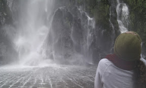
There were so many waterfalls everywhere. The boat carefully approached one. A member of the crew stood on the bow in his rain coat with 2 empty jugs ... and the skipper managed to fill them both from the waterfall. Even though we stood well back, we got totally soaked!

We were able to go out far into the Tasman Sea, as there was no swell today. We turned around and headed back in. The scenery of the fijord is awesome. From snow capped peaks to seals, we saw it all. A crew member told a Maori traditional story related to the two turtle shaped rocks, which was great. One of the highlights being a pod of playful dolphins that rode the bow wave and hung around for photos for at least 10 minutes!

The boat carefully manouvered towards a cliff face and stopped with inches to spare. It was 700m of vertical rock and looking up from the bow was really amazing.

As we were almost back in port, we spotted a group of kayakers enjoying a paddle in the fjord and a helicopter tour enjoying an ariel view of this magnificent area.

Wow, what a trip we'd had! We headed back the way we came along the road and stopped at the Routeburn track entrance. The Routeburn track is listed as one of New Zealand's Great Walks and we took the first part of the trail to Summit point. At the top was a small lake and fantastic views over the surrounding mountains. Very impressive! The way down, as always, seemed quicker. We hopped in the car and drove on to our campsite for the night.


Albatross ... ?

After breakfast, we took a drive along the Otago Penninsula Low Road. Our first stop being a cute little pottery shop which sold all sorts of items from around the world. It even had some older items from Poole Pottery!

Next, we took a trip to the Portobello school to see what a small New Zealand school was like... The children were very polite, very well behaved and the school had a range of nice new ipads to use! The deputy head even helped us solve a mystery - the animal that makes strange cackling noises in the middle of the night, and wakes us up ... is a possum!

At the end of the Penninsula we spotted a penguin and a seal on the beach. However, it was not windy enough to see the animal we were there to see, the albatross! There was a visitors centre and some nests but today, no birds flying above!

We had lunch at a house on the beach before visiting a small family business making pottery hens, very beautifully painted by hand. Next was a trip to a Maori Marae which was a bit like a meeting house and covered in exquisite carvings. We learnt a little about the Maori culture, which was really interesting.

Finally, we left the Penninsula behind and late in the afternoon and visited the Otago museum. They had exhibitions on people, art, ships and our favourite was ... the animals.

Just before we headed back for dinner, we went to visit the steepest street in the world according to the Guinness Book of Records, Baldwin Street, and .... it was steep!

Dunedin

We left the campsite and travelled to Palmerston. A small town in a gold mining region. It was fairly early and even the tourist office was closed so we moved on to the next stop.

We drove along the coast to see the view from the sea cliffs, but the view was hidden by the mist so we continued on to Dunedin. We wandered around the town and saw St Andrew's church and the very grand, old railway station. Apparently this is the most photographed building in whole town and very beautiful it is!

Next, we went to the Settlers Museum which was full of information dating back to the first explorer who sailed into Dunedin, a Scottish man, hence the name. In fact most things in this area can be related back to Scotland and have Scottish 'sounding' names. The museum was really good and had many displays from the early times in NZ to modern society. We remembered many of the items on display from the 70's, including; Tupperware cups, an old hairdryer complete with multicoloured cap and the Sinclair ZX80 first home computer. We even played on an Atari console, if anyone remembers them!

We stayed the night just inside the Otago Peninsula. We were perched fairly high up with the most wonderful view of the city lights.

Heading South

We left Dunedin after a lazy breakfast and had a whole day of driving ahead of us. We first followed the Southern Scenic Route south along the coast. We passed through many new housing areas on the cliff top as we left Dunedin and the view was great!

We passed through a large town called Balclutha and headed off to Kaka point. The beach there was wonderful, so we set up our camping chairs and had lunch whilst admiring the scenery.

Back in the car again, we back tracked to Balclutha and headed inland to Gore. A quick stop at Countdown (supermarket) to stock up before the long trip to Te Anau.

In Te Anau we stopped at the i-center to collect information on what to do in the area, before it began raining. We battled to get the tent up in the rain, though we managed to keep the inner part dry ...

Tuesday, 1 April 2014

Penguins and seals

A lazy start saw us travelling towards Moeraki. At Moeraki there was a famous sea food restautant and a quaint little harbour. It was really quiet, no-one seemed to be around!

We drove on to visit the Moeraki Boulders. Perfect spherical 'rocks' on a beach, not formed by the sea but by a process beginning with a shell?!

On to the lighthouse, tucked away on a remote track. There was a yellow eyed penguin viewing area, so we went for a walk. We spotted a couple of penguins up close and another walked straight in front of us across the path. Wow! We walked along a quiet track along the headland and there were seals everywhere. We spotted a whole group frolicking in the water and others sunning themselves on the rocks.

After all of this excitement, we set up the tent in a DOC campsite and headed into the forest following a loop track. It took us up to a big rock overhanging a deep gorge. It was scary looking down but there were views all the way to the ocean.

Back of beyond

After breakfast we packed our tent and drove about 10km down a gravel track to a remote camping area. We didn't intend to stay for the night but the campsite gaves us access to a number of lovely river walks.

The road down to the camp took us across a small ford, along a wooden bridge and through various gates that Christine had to open.

We set off through the forest and the track led us to the river. The river at this time of year was small but fast flowing, though you could see that the river was huge at other times. A sign said we must cross the river as the track was on the otherside. However, there was no bridge. We were faced with taking our shoes off, rolling up our trousers and wading through or .. jumping across from rock to rock. We opted for the stepping stone option as the water was freezing and coming straight sown from the snow covered mountains. Our first crossing of the stream went well but we kept finding the track ending and stream crossings were needed again. Second time we crossed on a huge tree trunk, third time we tried to make a bridge and Christine got soaked (tee hee ..) and on our final crossing, we almost got stuck standing on a rock in the middle!

The walk led us along the river and through a pretty forest but we turned back early as it got harder and harder to cross the stream. We ate lunch back at the car before driving towards Oamaru.

On the journey we stopped at a glided base in Otematata to watch a glide being launched. We stopped again to see the Takiroa Maouri paintings and to visit a cute little church. Finally, we arrived in Oameru.

Oameru was a fantastic spot. It had a wonderfully preserved Victorian street, with one store selling ... Marmite and chips favoured fudge. There was another wacky warehouse full of rusting old trains made into gunships and other weird sculptures! A lovely Marina, a penguin viewing area ... a great town. We walked along the harbour wall watching the local fisherman checking out the boats. We saw a colony (hundreds) of birds but didn't recognise the species.

5 minutes down the road was another beach where yellow eyed penguin come ashore each evening. We made our way there and first spotted seals on the beach before a lone penguin arrived just before dark. We took lots of photos!

Time to find a spot for the night, so we headed to a DOC campsite with a wonderfully soft grassy area to pitch the tent...

The climb

Today was trekking day. We were going to follow a track up Mt Sefton to the Mueller mountain hut. The track was to take us 3.5 hours up, climbing all the way before returning 3.5 hours back down!

After a double ration of porridge for breakfast we started the climb up the track. For the first 10 minutes, we were led into a false sense of security as the track was nice and gentle ...

However, that soon changed! The next part was steps, followed by rock hopping, then by scrambling. On the way a group of inquisitive kea came to join us. Kea are a native, large green parrot type of bird. When they open their wings the under side are beautifully coloured with red, blue and orange.

Eventually, we reached the ridge at the top. No more climbing up but a 30 minute flat walk to the hut. The view was great from here. You could see Mt Cook in the distance, surrounded by other snow capped mountains. We could see the glaciers making their way down the valleys finally becoming streams....

We made it to the hut and were welcomed by the volunteer wardens, who kindly offered us a cup of tea. We chatted to them for a while and discovered they are coming to England soon to complete the famous Coast to Coast walk! Soon other people arrived and joined the conversation including 3 people from a Canadian circus travelling around New Zealand.

We saw a number of small avalanche slide down the mountain opposite the hut. When we finally decided to leave, we said goodbye and started back down the slippery slopes. We passed lots of people heading up but we were glad to be heading down! We reached the bottom in good time and had a short rest before a short (ish) drive to lake Ohau for the night. En route we stopped at the supermarket. We picked up some dessert ... chocolate iced Christmas cakes!

Rowing - Maardi cup

After waking up by the lake, we packed our camping gear away. We waved goodbye to the friendly camp site supervisor who was fishing from his small boat and set out to Twizel.

We passed the pretty lake Pukaki, with its crystal clear blue water and some great mountain scenery. We also called into a little shop selling salmon. This area has many canals as part of a hydro electricity scheme where there are lots of salmon ...

Twizel was a small town and today they were hosting the 2014 Maardi cup. The Maardi cup is a huge secondary school rowing contest for the whole of New Zealand. We headed to the lake to watch the finals and it was packed! We overheard conversations in the visitors centre regarding accommodation... booked, booked, booked. Not just in Twizel but in the surrounding area up to around 100km!

We sat back and watched the excitement of the races unfold and ate our picnic down by the lake.

After we had had our rowing fix we started heading out of town towards Mt Cook. There was a small DOC 'scenic' camp that we were aiming for. We called in at the visitors centre on the way past to ask a few questions and there was also a Sir Edmund Hilary centre there too. The visitors centre was packed with information and beautiful displays relating to the history of mountaineering in the area.

Eventually, we arrived in the campsite and it became obvious why it was referred to as scenic! With a backdrop of mountain vistas, it really was amazing!